A Flood of Concerns: Why Fearrington Preserve’s Current Plans Risk Disaster on Morris Road
My name is Marjorie Hudson, and I live on Morris Road. As plans move forward for Fearrington Preserve and Pokeberry Creek Mitigation, planners continue to rely on outdated FEMA maps to establish flood lines. By ignoring the real-world conditions, they are turning a blind eye to the severe, recurring flooding that directly impacts the proposed build area near Morris Road.
Chronology of Catastrophe: Two Major Floods in Seven Years
September 18, 2018 – Hurricane Florence
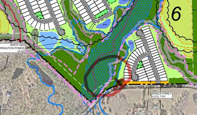
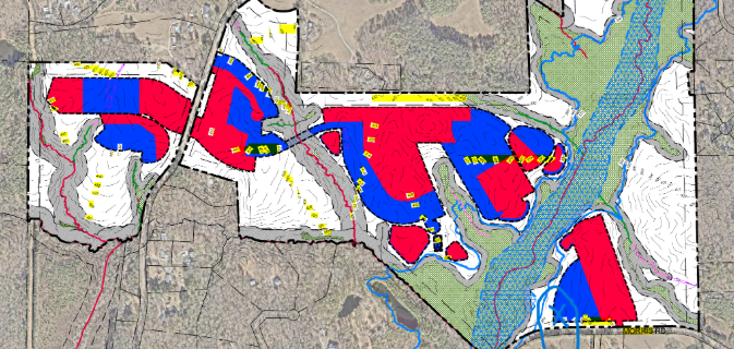
During Hurricane Florence, standing water roughly 200 feet uphill from the bridge reached depths of 8 to 10 feet, completely inundating land on the north side of Morris Road—land now designated for Fearrington Preserve. The roadbed acted as a dam, trapping floodwaters in the floodplain until they inevitably overwashed the road, blowing out culverts and washing out the roadway structure entirely.
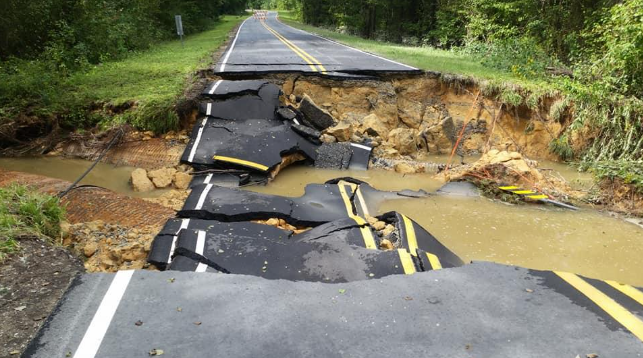
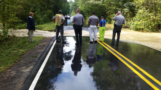
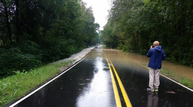
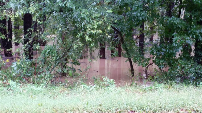
The actual flooded areas are marked on the current Fearrington Preserve development maps below, showing that areas underwater by up to 8 feet overlap directly with proposed building zones:
November 2018 – DOT Hardening Infrastructure
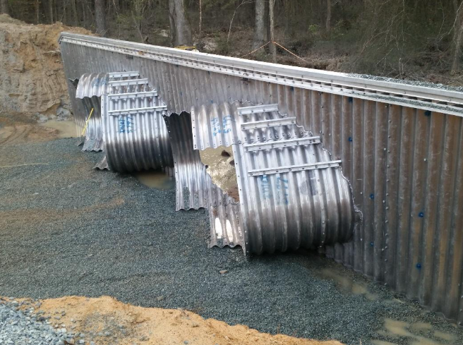
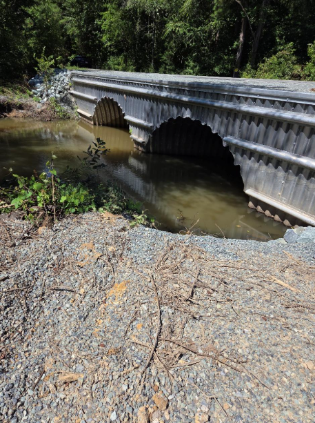
Following the 2018 collapse, NCDOT "hardened" the Pokeberry Creek crossing, expanding culvert sizes and installing a heavy steel structure reinforced with 52 tons of gravel fill to prevent future washouts.
July 7, 2025 – Tropical Storm Chantal
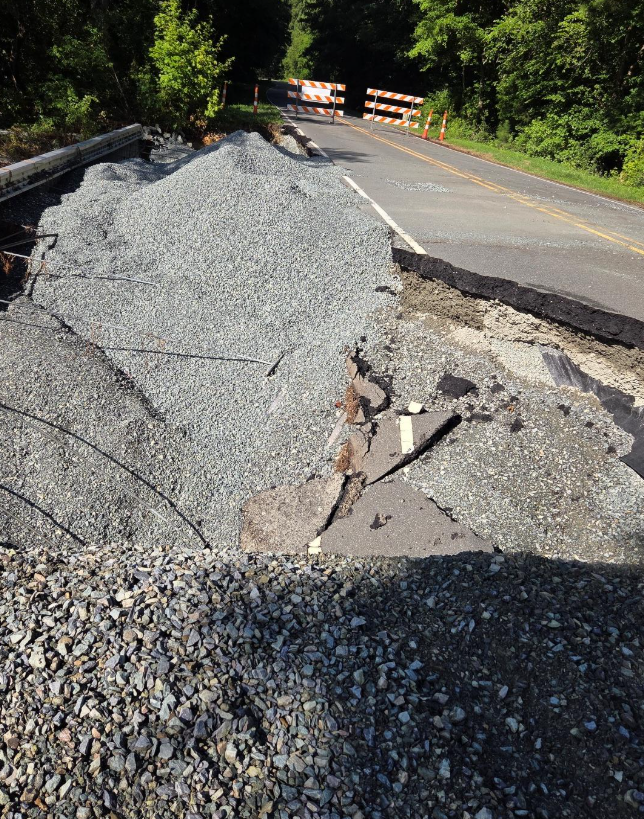
Despite NCDOT’s steel reinforcement, Tropical Storm Chantal brought 9 to 12 inches of rain that completely tore apart the steel-hardened structure and welded rods. The floodwaters pushed a massive log pile across Morris Road 200 feet uphill from the bridge and washed tons of gravel into the stream bed.
This displaced gravel created a large sediment dam, blocking Pokeberry Creek's natural flow and leaving it in a constant state of overflow. Even in a drought year, Pokeberry Creek at Morris Road has been turned into a 40-foot-wide lake.
Cause & Effect: Why Development Risks "Fouling Its Own Nest"
Because planners rely on outdated flood mapping, the fill plan and housing footprint for Fearrington Preserve extend directly into an active flood zone. Any future residents moving into these home sites risk severe flood damage without even being eligible for FEMA flood insurance coverage.
We have already seen this pattern play out in neighboring Briar Chapel, where stormwater control measures (SCMs), rooftops, and paved roads generated immense impervious surface runoff. Expert hydrologist testimony provided in previous hearings confirms that clearing forests, installing sprayfields, and adding rooftops in the northern portion of Fearrington Preserve will overwhelm SCMs and dramatically intensify flooding along Pokeberry Creek. In short, by repeating the design flaws of Briar Chapel, Fearrington Preserve risks flooding its own Morris Road housing pod.
Restoring Safety Through Ecological Buffers
In original documentation for Fearrington Preserve, the NC Natural Heritage Program requested a 200-foot buffer around Pokeberry Creek alongside efforts to eradicate nonnative invasive plants and replace them with deep-rooting native species. Native vegetation stabilizes soil and significantly absorbs rainwater.
Incorporating these ecological recommendations is a crucial step toward protecting surrounding homes. However, planners must redraw buffer boundaries using actual, updated flood data rather than relying on obsolete maps.
Key Questions for Pokeberry Mitigation
Before any further approvals are granted, the developer must address two vital questions regarding the Pokeberry Mitigation Project:
Why is there no projected timeline showing how Pokeberry Mitigation will integrate with the land clearing, grading, SCM construction, and utility installations?
If the Pokeberry Creek Mitigation Project is a binding commitment, why is there no formal letter of agreement with a detailed, integrated project plan and timeline in the public records?
A Call for Transparency and Responsibility
This severe flooding history is fully documented in public comments and logged on the new Chatham County flood reporting portal. Will developers and real estate agents disclose these known hazards to prospective home buyers and investors?
“Having stood in the middle of Morris Road to block unsuspecting drivers from plunging into hidden, roaring floodwaters, I know firsthand how dangerous these events are. As Sheriff Mike once shared with me, "You never forget a flood." It is traumatic, deafening, and unpredictable. The build area for Fearrington Preserve has suffered two catastrophic floods in seven years—we cannot afford to ignore reality any longer.”